 India Today ·
Science and technology
Nepal floods: First study reveals how warming Himalayas led to a mountain collapse
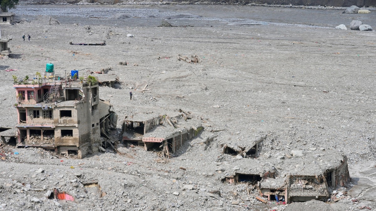
The deadly Nepal-Tibet disaster was triggered by a massive rock-and-ice collapse. The first analysis studying the disaster has examined how a warming Himalaya may have made the slope more vulnerable.
Climate change likely destabilised the Himalayan mountain slope that collapsed on August 26, triggering the deadly Nepal-Tibet flood disaster that killed over 1,300 people, according to a new scientific analysis.
While initial reports suggested that the event may have been caused by an earthquake, later evidence points to a rapid avalanche collapse of roughly 2 sq km of rock wall and glacier ice.
The collapsing mass fell about 1,400 metres, from around 5,150 metres above sea level to the valley floor at about 3,750 metres. The enormous release of energy generated seismic waves that were initially detected as an earthquake-like signal.
The findings from the World Weather Attribution (WWA) suggest that human-caused warming may have weakened the mountain landscape by shrinking glaciers and thawing permanently frozen ground, making slopes more vulnerable to collapse.
WWA is an international scientific collaboration that analyses and determines how much human-induced climate change influenced the intensity and likelihood of recent extreme weather events.
The disaster began when a massive section of rock and glacier ice broke away high in the Himalayas near Nepal's border with China.
The collapse sent a torrent of water, ice, rock and debris down the Trishuli River corridor, destroying infrastructure and killing or leaving thousands of people missing.
The avalanche collapse was not just a fall of ice.
Rock and glacier ice broke away together, gathered speed as they plunged downhill and transformed into a powerful debris flow.
The sudden movement also produced the seismic signal that was initially interpreted as an earthquake, before the collapse was identified as its source.
WHAT HAPPENED IN NEPAL AND TIBET?
The collapse occurred at around 5,150 metres above sea level near Langtang Lirung.
Roughly 2 sq km of rock wall and glacier ice collapsed and travelled about 1,400 metres downhill, transforming into a powerful debris flood before becoming largely water-dominated.
The resulting surge reached the Rasuwagadhi border 22 km downstream in just seven minutes, travelling at an average speed of about 188 kmph, sweeping through settlements, roads, bridges and hydropower infrastructure.
The death toll has crossed 1,300, with more than 5,000 people still missing, according to the Associated Press.
“This disaster was not an extreme weather event,” said Ben Clarke, a climate researcher at Imperial College London who worked on the analysis, but added that “the fingerprints of climate change” can be seen in the long-term changes.
The researchers found that warming has pushed the altitude of permanently frozen ground upwards by about 100 metres per decade.
As frozen ground thaws, ice-filled cracks inside mountains can weaken, potentially making slopes less stable.
Glaciers have also been retreating. The Langtang Lirung glacier has shrunk by about half a kilometre since the 1990s, exposing rock that was previously held beneath ice.
The analysis also found that July and August 2026 were the warmest such months recorded locally.
The findings come as Nepal presses for greater international support for climate-related losses.
Nepal has requested $20 million from the UN's Loss and Damage Fund, while the government estimates the damage from recent disasters could exceed $5 billion and says more than 20,000 homes may need rebuilding.
The nation has also demanded compensation from countries that are the top 3 global emitters. That includes India, which is the third-largest emitter after China and the US.
WHAT'S HAPPENING IN THE HIMALAYAS?
The Himalayas are warming rapidly. That means the glaciers are shrinking, snow cover is changing and the permanently frozen ground, called permafrost, that helps hold mountain slopes, is degrading.
These changes are making some high-altitude landscapes increasingly unstable.
As glaciers retreat, meltwater is also expanding glacial lakes, raising the risk of sudden glacial lake outburst floods.
At the same time, thawing permafrost can weaken mountain slopes, increasing the risk of landslides and rockfalls.
The changes have consequences far beyond the mountains.
The Hindu Kush Himalaya feeds major river systems that support hundreds of millions of people.
Scientists warn that continued warming could disrupt both mountain ecosystems and the water resources downstream communities depend on.
The latest research strengthens the argument that climate change is adding new risks in a region already exposed to landslides, floods and glacier-related hazards.
For the Himalayas, that means a warmer climate is not only changing how much ice the mountains hold, but may also be changing how securely those mountains hold together.